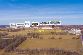
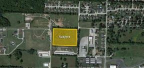
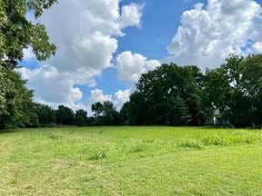
- For Sale $1,350,000
- Property Type VacantLand
- Lot Size 77.65 Acre
- Building Class B
- Date Updated Jan 23, 2025
Reach out to the broker for more info on lease terms and amenities
Attachments
Highlights
- SALE PRICE:$1,350,000
- LOT SIZE:77.65 Acres
- PRICE / ACRE:$17,386
- ZONING: Residential
- # OF LOTS:267
False
Contacts
Location
Getting Around
-
Walk Score ®
9/100 Car-Dependent
-
Bike Score ®
27/100 Somewhat Bikeable
- City clever, MO
- Neighborhood Clever
- Zip Code 65631
Points of Interest
-
Next Stop
6.42 miles
-
Kum & Go
6.77 miles
-
Casey's
7.27 miles
-
Murphy USA
7.36 miles
-
Conoco (Trucks)
7.58 miles
-
Conoco (Cars)
7.59 miles
-
Shell
7.75 miles
-
Kum & Go (Trucks)
8.85 miles
-
Kum & Go (Cars)
8.88 miles
-
Conoco
8.97 miles
-
4. Sigel's Second Position and Sharp farm fields
5.95 miles
-
5. Sigel's Final Position and Sharp Farm site
6.08 miles
-
Horse Trailer Parking
6.15 miles
-
6. Guibor's Battery (Parallel Parking)
6.28 miles
-
7. Bloody Hill and Totten's Battery
6.53 miles
-
3. East Battlefield Overlook
6.56 miles
-
8. Route of Union Advance & Withrawal (Parallel Parking)
6.85 miles
-
2. Ray Farm
7.15 miles
-
1. Gibson's House and Mill
7.38 miles
-
AmericInn by Wyndham Republic
7.52 miles
-
Super 8 by Wyndham Nixa/Springfield Area
9.38 miles
-
Clever Cafe
1.11 miles
-
Rocco's Pizza
6.43 miles
-
DQ Grill & Chill
6.46 miles
-
E's Inn
6.49 miles
-
Domino's
6.62 miles
-
Taco Bell
6.73 miles
-
Sonic
6.97 miles
-
Pizza Hut
7.00 miles
-
Long John Silver's
7.07 miles
-
KFC
7.07 miles
-
Clever School
0.64 miles
-
Brown Springs School
3.78 miles
-
Billings School
5.48 miles
-
McCulloch Elementary School
6.96 miles
-
Schofield Elementary School
7.02 miles
-
Republic Middle School
7.08 miles
-
Price Elementary School
7.10 miles
-
Republic Early Childhood Center
7.35 miles
-
Sweeny Elementary School
7.41 miles
-
Lyon Elementary School
7.43 miles
-
Hope Childcare Center
7.29 miles
Looking for more in-depth information on this property? Find property characteristics, ownership, tenant details, local market insights and more. Unlock data on CommercialEdge.

SVN | Rankin Company


