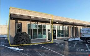
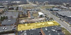
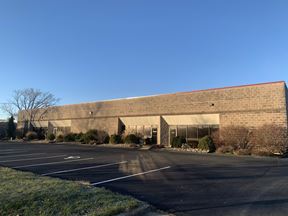
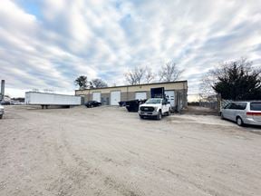
- For Lease $10.25/SF/YR
- Property Type Industrial
- Property Size 60,000 SF
- Year Built 1969
- Date Updated Apr 1, 2025
Reach out to the broker for more info on lease terms and amenities
True
Spaces Available
#8229 |
Manchester Road Improvements • Improve pedestrian access • Safety • Enhance the overall appearance of Manchester Road from Hanley Road to Bremerton Road Deer Creek Greenway Connector Enhanced greenway • Greenway linking multiple parks • .65-mile long paved trail • Potential to connect more than 28 miles of greenways Deer Creek Mitigation Provide a greater opportunity for businesses to move to the area • Streambank stabilization • Native vegetation planting • Natural floodplain restoration (benching and widening)
|
Contacts
Location
Getting Around
-
Walk Score ®
52/100 Somewhat Walkable
-
Bike Score ®
48/100 Somewhat Bikeable
- City St. Louis, MO
- Neighborhood Brentwood
- Zip Code 63144
- Market St Louis
Points of Interest
-
Clayton
2.42 miles
-
Discovery Corner Station
3.13 miles
-
The Wild Station
3.25 miles
-
Skinker
3.40 miles
-
University City Library
3.55 miles
-
Leland Avenue
3.61 miles
-
Missouri History Museum/Forest Park
3.72 miles
-
Delmar Loop Metrolink
3.90 miles
-
Forest Park - DeBaliviere Metrolink
3.91 miles
-
Delmar Loop
3.94 miles
-
Sam's Club
0.72 miles
-
QuikTrip
0.86 miles
-
Mobil
0.92 miles
-
Electric Car Charging Station
1.05 miles
-
Quik Trip
1.07 miles
-
Circle K
1.18 miles
-
Phillips 66
1.20 miles
-
Shell
1.60 miles
-
BP
1.65 miles
-
Tesla Supercharger
4.29 miles
-
trailhead
0.29 miles
-
Deer Creek Park
0.37 miles
-
church parking
0.91 miles
-
Brentwood Promenade
1.12 miles
-
Citizens Bank Parking
1.22 miles
-
Lot J
1.46 miles
-
Lot K
1.46 miles
-
Lot I
1.52 miles
-
Popeyes
0.13 miles
-
Arby's
0.44 miles
-
Cousin Hugo's Restaurant
0.53 miles
-
Red Lobster
0.60 miles
-
McAlister's Deli
0.61 miles
-
Twin Peaks
0.63 miles
-
Applebee's
0.67 miles
-
Qdoba
0.78 miles
-
Yummi Tummi
0.81 miles
-
Raising Cane's
0.84 miles
-
Gordon Food Service
0.60 miles
-
Schnucks
0.61 miles
-
Ross
0.63 miles
-
ALDI
0.65 miles
-
Walmart Supercenter
0.88 miles
-
Dierbergs
1.14 miles
-
Burlington
1.17 miles
-
Trader Joe's
1.17 miles
-
Target
1.22 miles
-
Whole Foods Market
1.24 miles
-
Brentwood Fire Department
0.72 miles
-
Maplewood Fire Department
0.72 miles
-
Brentwood Police Department
0.74 miles
-
CVS Pharmacy
1.24 miles
-
Rock Hill Police Department
1.31 miles
-
Shrewsbury City Police Department
1.36 miles
-
Shrewsbury City Fire Department
1.37 miles
-
Rock Hill Fire Department
1.39 miles
-
Webster Groves Fire Department
1.59 miles
-
Richmond Heights Fire Department
1.63 miles
Frequently Asked Questions
The average rental rate for industrial/warehouse space at 8229 - 8273 Brentwood Industrial Dr is $10.25/SF/YR. Generally, the asking price for warehouse spaces varies based on the location of the property, with proximity to transportation hubs, access to highways or ports playing a key role in the building’s valuation. Other factors that influence cost are the property’s age, its quality rating, as well as its onsite facilities and features.
The property at 8229 - 8273 Brentwood Industrial Dr was completed in 1969. In total, 8229 - 8273 Brentwood Industrial Dr incorporates 60,000 square feet of Industrial space.
For more details on this listing and available space within the building, use the contact form at the top of this page to schedule a tour with a broker.
Conveniently, 8229 - 8273 Brentwood Industrial Dr is located within 0.5 miles of 2 parking option(s).
Reach out to the property representative or listing broker to find out more about climate control capabilities at this property. Climate control is typically present in industrial buildings that are suited to store items susceptible to temperature and damage from humidity, such as food, pharmaceuticals, paper, textiles, and electronics.
Looking for more in-depth information on this property? Find property characteristics, ownership, tenant details, local market insights and more. Unlock data on CommercialEdge.


