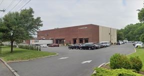
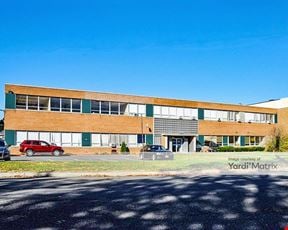
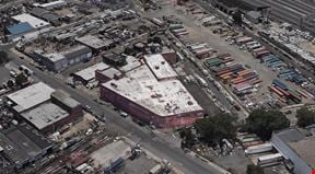
- For Lease Contact for pricing
- Property Type Industrial
- Property Size 348,281 SF
- Date Updated Apr 10, 2025
Reach out to the broker for more info on lease terms and amenities
True
Spaces Available
Space Available |
|
Contacts
Location
Getting Around
-
Walk Score ®
20/100 Car-Dependent
-
Transit Score ®
43/100 Some Transit
-
Bike Score ®
31/100 Somewhat Bikeable
- City Newark, NJ
- Neighborhood Newark Airport
- Zip Code 07114
- Market New Jersey
Points of Interest
-
P4
1.10 miles
-
Newark Liberty Airport
1.30 miles
-
P3
1.64 miles
-
Taxi Newark Airport
1.66 miles
-
Terminal A
1.88 miles
-
Washington Street
2.21 miles
-
NJPAC/Center Street
2.24 miles
-
Harrison
2.30 miles
-
Harriet Tubman Square
2.54 miles
-
Atlantic Street
2.56 miles
-
Valero
0.85 miles
-
Gulf
1.02 miles
-
Lukoil
1.15 miles
-
Mobil
1.29 miles
-
BP
1.35 miles
-
Exxon
1.44 miles
-
Sunoco
1.47 miles
-
Speedway
1.50 miles
-
Tesla Supercharger
3.08 miles
-
Greenspot
7.46 miles
-
Lot 151
0.30 miles
-
P6 Economy Long Term Parking
0.31 miles
-
Hertz Equipment Services
0.97 miles
-
Newark Liberty Parking
1.05 miles
-
P4 Garage Valet
1.11 miles
-
Terminal C Parking
1.15 miles
-
P4 Garage Daily Parking
1.19 miles
-
The Parking Spot Haynes
1.19 miles
-
Cell Phone Lot
1.25 miles
-
Terminal B Parking
1.30 miles
-
Wendy's
0.80 miles
-
Dunkin'
0.80 miles
-
Golden State Diner
0.84 miles
-
Happy Clam
0.85 miles
-
Nonna's Meatball Kitchen
0.88 miles
-
Worldwide Fried Chicken
0.89 miles
-
Philly Cheesesteaks
0.89 miles
-
The Deli
0.90 miles
-
Wabi Sabi
0.90 miles
-
Purse Dumpling Den
0.90 miles
-
Angelo's mini market
1.35 miles
-
Seabra's Market
1.45 miles
-
Seabra Foods
1.46 miles
-
Selectos supermarket
1.47 miles
-
Superfresh Supermarket
1.48 miles
-
ABC Super Store
1.57 miles
-
SaveSmart of Newark
1.58 miles
-
70 Adams Street Plaza
1.64 miles
-
Bonzão Supermarket
1.66 miles
-
Met Foodmarkets
2.21 miles
-
Planned Parenthood
1.63 miles
-
E10 L5 R1 Arson HQ
1.73 miles
-
Walgreens
1.73 miles
-
365 Care
1.78 miles
-
Police department: 1st precinct
2.06 miles
-
Rutgers Public Safety and Security
2.34 miles
-
NJIT Public Safety
2.39 miles
-
Newark Beth Israel Medical Center
2.42 miles
-
Bergen Street Pharmacy
2.46 miles
-
Saint Michael's Medical Center
2.58 miles
Frequently Asked Questions
The price for industrial space for lease at 339 & 340 Brewster Road is available upon request. Generally, the asking price for warehouse spaces varies based on the location of the property, with proximity to transportation hubs, access to highways or ports playing a key role in the building’s valuation. Other factors that influence cost are property age, quality rating, as well as onsite facilities and features.
In total, 339 & 340 Brewster Road incorporates 348,281 square feet of Industrial space.
For more details on this listing and available space within the building, use the contact form at the top of this page to schedule a tour with a broker.
Conveniently, 339 & 340 Brewster Road is located within 0.5 miles of 2 parking option(s).
Reach out to the property representative or listing broker to find out more about climate control capabilities at this property. Climate control is typically present in industrial buildings that are suited to store items susceptible to temperature and damage from humidity, such as food, pharmaceuticals, paper, textiles, and electronics.
Looking for more in-depth information on this property? Find property characteristics, ownership, tenant details, local market insights and more. Unlock data on CommercialEdge.

Realterm


